


Description
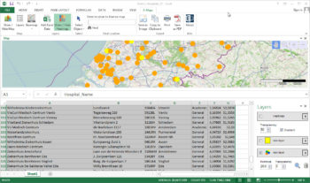
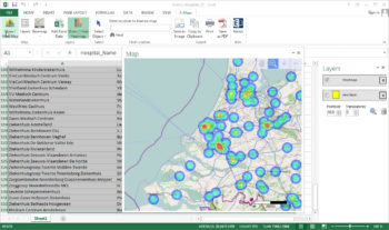
The quickest map in Excel. Visualize your data in Excel. E-Maps is a unique plug-in, designed for Excel 2007, 2010, 2013 and 2016. E-Maps enables you to generate professional maps within a few clicks. Point maps, thematic points, heatmaps. It is all possible. And just a few clicks further, you have saved your map as an image, copied it in your powerpoint, as PDF or as a print. If you do not have coordinates in your data, you can plot your addresses on the map by a geocoding them. The coordinates will not be stored in Excel. E-Maps is sold based on a yearly subscription. E-Maps for Excel™ is available in three versions
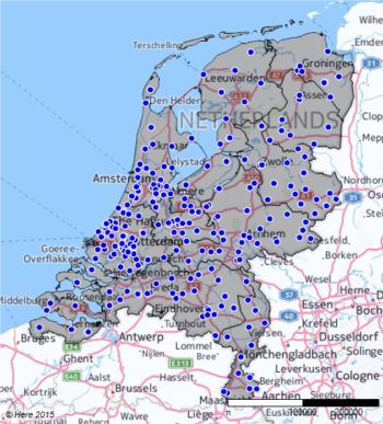
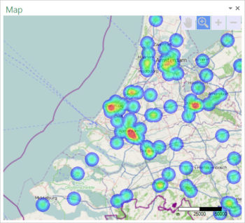
- Standard – Points will be placed on a map based on coordinates or postal / full address by geocoding with world coverage. Geocoded data can only be viewed on map, the coordinates will not be stored in your Excel sheet. The background that can be selected is Here (Roads, Aerial and Hybrid) or blank.
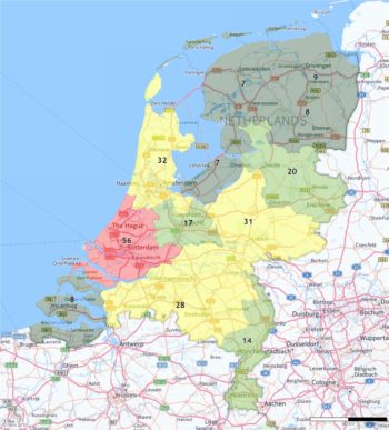
- Pro – Same as Standard but also includes thematic maps, visualize shape files. Save your map as a project and continu working the next time you open Excel. More backgroundmaps like OpenStreetMap and export to layered PDF.
- Advanced – all features of the Pro version plus advanced selecting and drawing capabilities. Make a selection of locations based on travel time and/or -distance from a given point using car or walking. Draw a line, circles, shapes or a point to enhance your maps.
View all functionalities of both versions at: www.map-in-excel.com