Excel E-Maps

Starting at 99,00 excl. VAT

Excel E-Maps is your Map In Excel. Buy your license online and activate with the unique activation code. Your license is valid for one year. The licence can be renewed annually, by a new purchase from this webshop.
E-Maps is available as Standard, Pro, Advanced and Mobility. See our overview for the specifications.

Category:

Description

E-Maps: The fastest map in Excel

Get the easiest map in Excel. Visualize your data on high quality maps. E-Maps is a unique plug-in, designed for Excel 2007, 2010, 2013, 2016, 2019 and Office 365 (desktop). E-Maps enables you to generate professional maps within a few clicks.
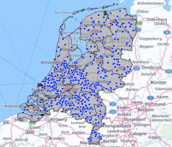
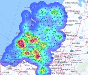
Point maps, thematic points, heatmaps. It is all possible. And just a few clicks further, you have saved your map as an image, copied it in your powerpoint, as PDF or as a print. If you do not have coordinates in your data, just plot your addresses on the map by a geocoding them. Every time you plot the data, coordinates are stored in memory and not stored in the Excel sheet.
E-Maps is sold based on a yearly subscription. E-Maps for Excel™ is available in four version:, Standard, Pro, Advanced and Mobility.

Compare the various versions at: www.map-in-excel.com

You can find Excel E-Maps Mobility here. For technical support and explanations, take a look at the tutorials.

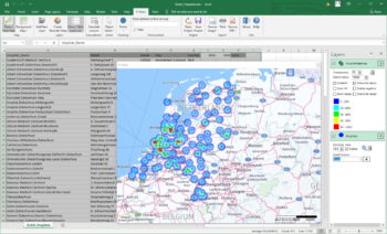
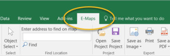
After installing E-Maps, E-Maps can be found in a separate tab in Excel.

Do you want to try E-Maps Pro 14 days for free? Then try the Pro trial version. The trial version does not support export of maps in a high resolution.

Additional information

Edition

Pro, Standard, Advanced, Mobility, Pro Trial

Standard

Points will be placed on a map based on coordinates or postal / full address by geocoding with world coverage. Geocoded data can only be viewed on map, the coordinates will not be stored in your Excel sheet. The background that can be selected is Here (Roads, Aerial and Hybrid) or blank.

Pro

Same as Standard but also includes thematic maps, visualize shape files. Save your map as a project and continu working the next time you open Excel. More backgroundmaps like OpenStreetMap and export to layered PDF.

Advanced

Same as Pro plus advanced selecting and drawing capabilities. Make a selection of locations based on travel time and/or -distance from a given point using car or walking. Draw a line, circles, shapes or a point to enhance your maps

Mobility

Same as Pro plus the possibility to calculate travelling times and distances for car, public transport, bike of pedestrian.

Pro Trial

Trial version of E-Maps Pro. Try E-Maps Pro 14 days for free!

0
    0
    Uw winkelwagen
    Your cart is emptyReturn to Shop